Lab 3: Web AppBuilder for ArcGIS
Goals and Background:
This lab introduced the basic concepts of building an application
for Web GIS while using the Web AppBuilder for ArcGIS. This program is located
on a desktop on the developer’s side, rather than the platform strictly on
ArcGIS Online. Widgets, or tools, can be modified and created within this
desktop program that could then be published to the web. Although no coding
would take place during this lab, it was noted to at least ponder what was
going on in the background from a coding perspective.
Methods:
Part I
The first part of this lab was to select the aesthetic elements and create the basic widgets of the app. This process would occur on ArcGIS Online within the Web AppBuilder application. The basis of this web map would be the Natural Disasters application that was created from a previous lab. After selecting a theme and the map, the widgets would be added.
The first widget that was added was the “Measurement” tool and the next one was “Bookmark”. The Bookmark widget was configured by adding two bookmarks. The first bookmark was a function that zoomed to a view of the western United States. The other bookmark was a view that moved to the eastern half of the country.
Next, elements of the app were customized. A title for the URL, a logo from the University of Wisconsin – Eau Claire, and a link to the Geography Department were are all added. After these minor tweaks, the application was shared publicly so it would be accessible in a subsequent portion of this lab.
After these steps, more widgets would have to be added to the app. The next widgets added were the “Chart”, “Draw”, and “Query” widgets. These would have to be customized so an end-user could utilize them within the application. The first modified widget was the Chart tool. The “Earthquakes” layer was the target of the Chart tool. Magnitude and depth (km) were configured to show graphs pertaining to user selected earthquake locations on the map.
The next widget that was customized was the Query tool. Expressions were setup within the configuration menu. This setup process did not require knowledge of SQL as the Web AppBuilder offered terms in English syntax that an average end-user would be able to understand. Queries were configured to have users be able to search for earthquakes with certain magnitudes and earthquakes in certain locales.
Part II
The final part of this lab dealt with the creating of an app through the Developer Edition of Web AppBuilder. It offers more customization options compared to the online version. The Developer Edition launched in the browser once connected to the UWEC server through a specific domain. Registration with ESRI was required before the app could be launched onto ArcGIS Online. Once the necessary credentials, an App ID, were provided, Web AppBuilder could then be accessed.
After allowing Web AppBuilder to access the personal ArcGIS account information tied to UWEC, the import app function was made available. However, the application that was created previously in this lab was unable to be imported. After further research, it was discovered that a newer theme was present on the online-based app. This was incompatible with the desktop-based Web AppBuilder due to the program being an older version compared to the newer, online one. The new app was built from the ground up on the online platform.
The next step was to upload a widget that was not present on either the desktop or web-based Web AppBuilder. This was accomplished by moving the ElevationProfile widget folder inside the client-stemapp-widgets folder within the WebAppBuilder program file on the desktop. The new Elevation Profile widget was now accessible within Web AppBuilder. The widget was then added to the app and a few preferences were tweaked.
The final step of this lab was to make the app accessible to anyone who possessed the URL. The app was downloaded from the web-based Web AppBuilder and the compressed folder was unzipped into a personal folder. Then, the production server was connected to the Internet by mapping a network drive. The Z-drive was selected and the \\geog01\webgis$ path was mapped out. The app was now a fully functional Web GIS app.
Results:
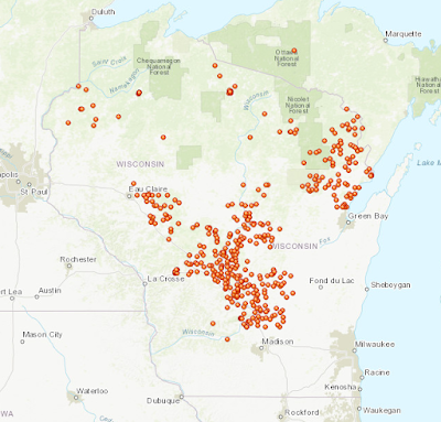
The outcome of this lab yielded an app (Figure 1) that was accessible to all by entering the URL: http://webgis.uwec.edu/loftsgsj/Naturaldisasters_app/index.html
 (Figure 1) This is an image of the initial view an end-user would see once they entered the associated URL and accessed the app.
This app possessed a total of seven individual widgets that any end-user could utilize. One of the more interesting widgets was not initially available on either platforms of Web AppBuilder. This was the Elevation Profile widget that had to be uploaded from a specific desktop at UWEC. It allowed for users to create topographic profiles (Figure 2) of anywhere on the basemap.
 (Figure 2) This is an image of the topographic profile created by the Elevation Profile widget. It was taken from an area of the Rocky Mountain Range within the state of Idaho.

This app possessed a total of seven individual widgets that any end-user could utilize. One of the more interesting widgets was not initially available on either platforms of Web AppBuilder. This was the Elevation Profile widget that had to be uploaded from a specific desktop at UWEC. It allowed for users to create topographic profiles (Figure 2) of anywhere on the basemap.

Sources:
Fu, Pinde (2015).
Census at: \\EsriPress\GTKWebGIS\Chapter3\Data.gdb\Earthquakes, courtesy of USGS National Atlas. \\EsriPress\GTKWebGIS\Chapter3\Data.gdb\Hurricanes, courtesy of NOAA National Climatic Data Center.
Census at: \\EsriPress\GTKWebGIS\Chapter3\Data.gdb\Earthquakes, courtesy of USGS National Atlas. \\EsriPress\GTKWebGIS\Chapter3\Data.gdb\Hurricanes, courtesy of NOAA National Climatic Data Center.
Comments
Post a Comment