Posts

Lab 3: Web AppBuilder for ArcGIS

Image
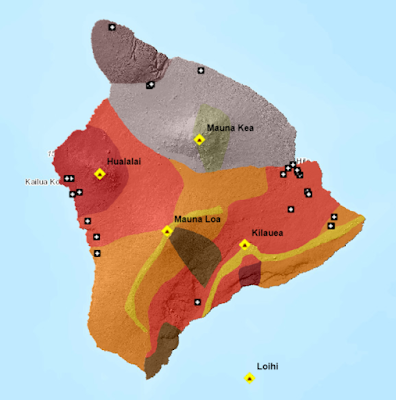
Goals and Background:   This lab introduced the basic concepts of building an application for Web GIS while using the Web AppBuilder for ArcGIS. This program is located on a desktop on the developer’s side, rather than the platform strictly on ArcGIS Online. Widgets, or tools, can be modified and created within this desktop program that could then be published to the web. Although no coding would take place during this lab, it was noted to at least ponder what was going on in the background from a coding perspective. Methods:   Part I  The first part of this lab was to select the aesthetic elements and create the basic widgets of the app. This process would occur on ArcGIS Online within the Web AppBuilder application. The basis of this web map would be the Natural Disasters application that was created from a previous lab. After selecting a theme and the map, the widgets would be added.   The first widget that was added was the “Measurement” tool and t...
Lab 2: Geospatial Web Services

Image
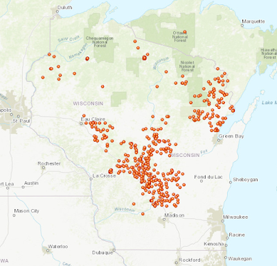
Goals and Background:   Lab 2 consisted of many sections that attempted to guide the user through the developer process of uploading web applications to an online platform. This lab would utilize ArcGIS Online, ArcGIS Pro, and as well as the traditional ArcMap. The steps one must go through to complete this lab eventually lead to an understanding of how the publishing process works. Various paths were taken to connect to the online platform ArcGIS Online. While ArcGIS Online is a powerful tool, it is limited in certain aspects of manipulating geospatial data. Lab 2 solved this conundrum by using desktop versions of GIS platforms. Methods: Part I   The first objective of this lab was to publish a feature hosted service using a shapefile through ArcGIS Online. This was accomplished by first downloading the zip file that contained all the relevant data from the University of Wisconsin – Eau Claire’s (UWEC) D2L website. Once within ArcGIS Online, the “Wisconsin_transpor...

Lab 1: Cloud GIS Basics

Image
Goals and Background:     The goal of this lab was to familiarize oneself with the ArcGIS Online platform as both a developer and an end user. ArcGIS Online is accessible to a much wider audience than that of the traditional ESRI ArcMap platform on a desktop computer. Due to ArcGIS Online’s simpler interface and reduced requirements regarding a device’s hardware, this platform is on the forefront of GIS technology.     This lab was separated into three parts. The first part of the lab dealt with how an end user might see the content and to delve into the core functions of ArcGIS Online like its sharing features and interactive legend. The middle section of the lab was a simple walk-through of the map creation process through a developer’s perspective. The final part was the most labor intensive portion of this assignment. The task was to create a story map of a University of Wisconsin – Eau Claire (UW-EC) geography class field trip that took place in Texas by uplo...